
We got
out of the LC at sunrise and walked down to the beach to watch four
surfers already catching waves. The wind had died down from the
previous couple days, and the waves coming directly onto the beach
were barely breaking. But off several hundred meters on the right
side of the beach there is a break that causes the water to rear up
into a famous set of waves. Today they were probably only a few
meters high, but it was enough to carry the surfers on a pretty good
ride. Like most surfing, however, the real action was punctuated by
long periods of waiting. I guess it's sort of like watching
football, except without the comfy couch and beer and Doritos.
 |
| Cactus Beach |
The
campground is very interesting. Surfers first started coming to
Cactus Beach, which is a long way from anywhere, in the late '60s and
used the area behind the dunes to camp. In 1986 a fellow named
Ronnie took over management and created a semblance of order. He's still there, wiry surfer build, long-gray hair under a bush hat, keeping tabs on everything when he's not surfing in Indonesia or Hawaii, or Africa. There
are flush toilets set in stone huts, barbeques made of a metal barrel
with a swing top lid and set on a pole so they can be rotated
depending on the direction of the wind, and a shelter with sink for
washing dishes, and another for doing laundry.
 |
| Breakfast |
 |
| Don't know how they fit that tipi in that tiny car |
 |
| This guy has been here for 5 years, it's a long drive to get a beer! |
The area north and west of Cactus Beach it at the edge of the wheat growing area of Eyre Peninsula, and there are some beautiful rolling fields of grain bordered by bands of gum trees.

Within a few miles all agricultural activity had disappeared and we
were driving through a more typical Australian landscape of gumtree
woods and open grasslands. As we were passing one large open area I
noticed what looked like giant prairie dog towns. We took a short
drive up a dirt road to investigate and found this;
 |
| Wombat hole |
That would explain the numerous dead wombats along the road, up to
three or four in a 100 meter stretch. The adults are the size and
shape of miniature black bears, so the carcasses can be quite large.
They are purely nocturnal except in the coldest weather, so we
haven't seen a live one in the wild yet, but with their dark gray fur
they'd be almost impossible to see lumbering across the road at
night.
A 150 km stretch of the road passes through the Yalata Aboriginal
Reserve. We didn't see a single sign of human presence until drove a
short way off the road to pass through the small town of Yalata. It
was a depressing sight. Prefab houses made up the majority of the
buildings, although there were a few run down site-built homes.
There were a number of junked cars scattered about, and trash nearly
everywhere, dirty old blankets making up a fair amount of the mess.
People were out walking around or sitting on front porches. There
was no commercial activity that we could see, the police station
surrounded by a high steel fence was the only other building there.
The closest minimal shopping would be at the Nundroo Roadhouse, 55 km
away, or Penong, with a small grocery store, 140 km away. The
closest real town is Ceduna, 202 km away, and we did see a couple
dozen aboriginals there, very much separated from the local white
people.
I know almost nothing about the current relationship between aboriginal communities and the government, how they are supported, what the sovereignty issues are. I do know that among almost all the white Aussies we've met there is a fear and distrust that is disconcerting to us. Perhaps it's a generational issue, since most of the people we've talked to are retirees. Certainly we didn't get that feeling from Kim. We'll have to ask her about it when we see her again in December.
I know almost nothing about the current relationship between aboriginal communities and the government, how they are supported, what the sovereignty issues are. I do know that among almost all the white Aussies we've met there is a fear and distrust that is disconcerting to us. Perhaps it's a generational issue, since most of the people we've talked to are retirees. Certainly we didn't get that feeling from Kim. We'll have to ask her about it when we see her again in December.
Max
and Andy, World Travelers
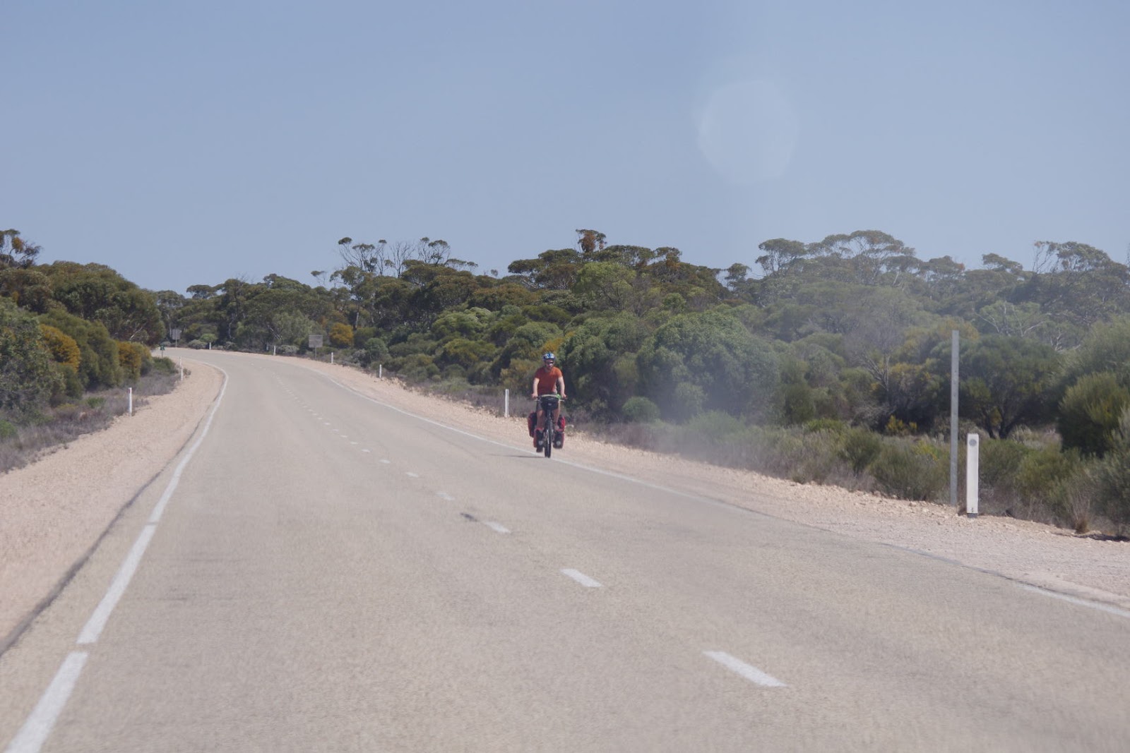
Just past the Yalata Community we saw a 'push biker' riding down the
lonesome road towards us, loaded with paniers and properly attired
for a road trek. Our first long distance biker! Diana got our the
camera and got a quick photo;
 |
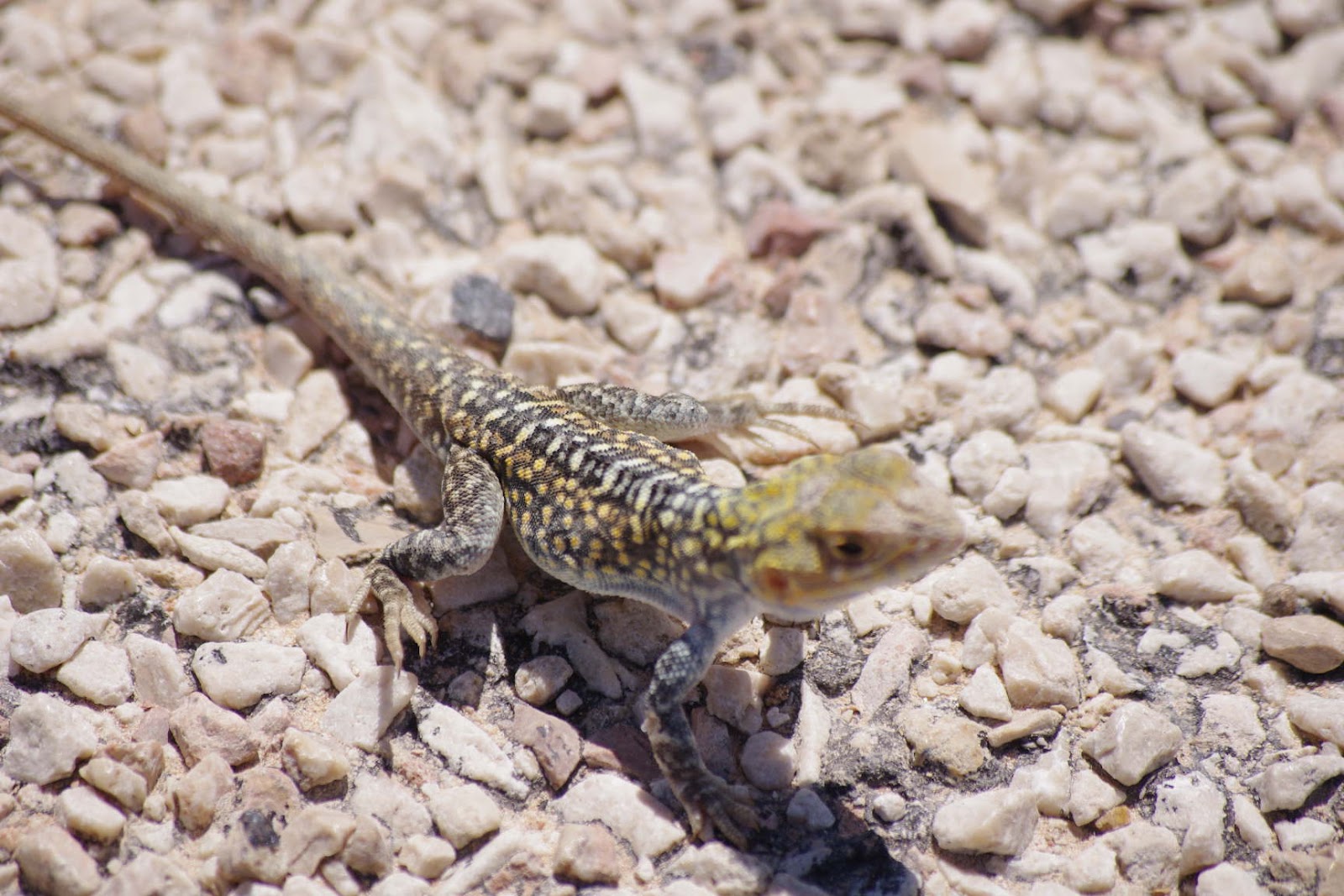
| We were hoping to see some of the above (that guy on the right is a wombat)... |
 |
| ... but spotted a couple of these instead |
About 25 kilometers later we saw another bloke on a bike pulling into
a rest area. I gave him a smile and thumbs up and he returned the
greeting. After a few hundred meters I decided to turn around and
see if I could chat him up. He was off his bike about to refill
water bottles at the water tank there. I said hi to him and told him
we could give him some real drinking water. I asked where he had
started his ride, expecting to hear Perth, but he answered London!
We ended up talking for almost a half an hour. He and his friend
Andy, who we'd seen earlier, left England in August 2011, rode
through Europe, Turkey, Iran, the 'stans of central Asia, China,
Laos, Malaysia, and then to Perth. No real problems the entire way,
just lots of friendly people. I could have talked to him for hours,
but we all had our own travels to continue. He's also keeping a
blog, which I'm anxious to read when I get a chance.
Nullarbor
means 'No Trees' in Latin, but doesn't mean you won't see any whales
or caves there

Soon after leaving Max we hit the boundary for the Nullarbor Plain.
The transition was fairly sudden. Through most of the Yalata country
there was total tree cover, not thick like a jungle, more like the
woods in northern Michigan, except gum trees instead of birch and
pine. Then, within the space of less than 15 kilometers they thinned
out and were gone. Nothing but flat land and salt and blue bush
shrubs.
One of the most anticipated animal sightings for me was seeing the
Southern Right Whales at the Head of the Bight along the coast on the
Nullabor Plain. The whales leave the cold, nutrient rich waters of
Antarctica to give birth to and raise their calves during the winter
months in the warmer waters off the south coast of Australia. The
babies gain up to 230 pounds a day nursing, and when they have put on
a thick enough layer of fat, mother and calf return to their feeding
grounds. The time to see the whales is from May to the end of
October, and I was afraid we might be arriving too late.
But after paying our entry fee and walking the short boardwalk to the
edge of the cliff we were delighted to see on mother/ calf pair just
a couple hundred meters off shore, with three other pairs within
sight. At the peak over 20 pairs can be seen, but we were satisfied.
 |
| "Hey mate, the whales are that way" "Thanks" "No worries" |
 |
| Looking at the Right Whale |
 |
| Mother and child |
We had been warned that the Right Whales are a lot less active than
the Humpback Whales we'd seen at Coff's Harbor, and they did mostly
float around like black submarines, occasionally showing a tail fluke
or poking their noses above the water. But it was thrilling
nonetheless.
We had a lunch of Tasty, vegemite and onion sandwiches at a picnic
shelter there, then headed on down the road to the Nullarbor
Roadhouse. A combination gas station, store, bar, motel, campground,
it's one of a series of roadhouses spread out at approximately 150 to
200 km intervals along the empty roads of Australia. Not glamorous
or exciting, but on thousands of miles of roads in the outback it is
the only sign of civilization. We filled up the tank with fairly
expensive gas and asked the way to the Murrawijenie caves. “Out
along the gravel road, back around the wind mill, and then it's about
20 k's, but the roads really rough”.
Meh, not so bad for Oz outback roads. We're starting to get used to
them, and have gained confidence that the LC isn't going to fall
apart bouncing over the corrugations, potholes, and rocky patches
that are typical for much of the rougher roads we've been on. Most
are rated 4wd, but that's mostly for when it rains. You can see long
dried ruts that would be a problem if muddy, but with less than 8
inches a rain a year for this part of the country, that doesn't
happen very often. Still, the higher clearance and sturdy new all
terrain tires are helpful.
The whole southern coast of Australia from the Eyre peninsula to well
into Western Australia is made of limestone laid down from an ancient sea 100's of millions of years ago. The rock is riddled with
cave and channels, all quite unapparent until you come right up to
them. We didn't see the Murrawijenie caves until we drove right up
to them. These caves are open to the public, although we haven't met
anyone yet who has heard of them, and we explored all three.
 |
| The view of the cave from ground level |
 |
| Now how do we get down there? |
 |
| Oh, I'm sure that dead old tree will hold your weight, Diana |
 |
| Looking for Aboriginal art |
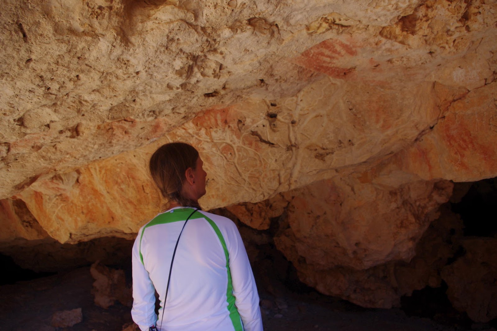 |
| Found it |
 |
| Now how did I get down here? |
We got back to the main road and headed to the Nullarbor National
Park to camp for the night. Interestingly, we began to see trees
again after just a couple hundred kilometers of nullarborness, although further north it's over 1100 km wide. It is still arid and
unpopulated, but most of Oz is the same. Heck, I'm sure west Texas
has at least three or four roads that go that far without trees, and
don't even get me started on Nevada. Still, most of the south coast
is called the Nullarbor Plain, trees and all, and I guess we'll just
have to leave it at that.
Only one of our four map sources actually showed a campground in the
park, which was supposed to be near an old homestead, a good 25 km
off the main road. As we headed off yet another rough dirt road at
sunset, trying to figure out which route to follow to find the
campsite, we were about to give up and just set up camp in the bush.
It's become a joke between us that after driving over a long rough
road I keep saying I'd be surprised if there is anyone at the
campsite by the time we get there, and sure enough, the are usually
three or four other vehicles there already set up for the night. As
we drove up the road I saw the glint of fading sunlight reflecting
off several car windows among the scattered trees and I laughed,
“yep, lots of campers here.” But as we drove up to the abandoned
house we realized that there were hundreds of junked cars scattered
around the property.
 |
| Kanoolda Homestead |
No comments:
Post a Comment